Posts

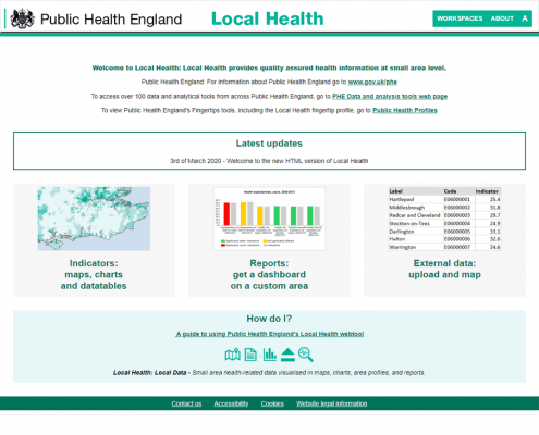
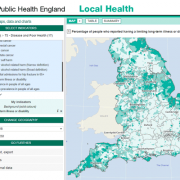
Exploring the health conditions in England

The Public Health Service in England has been publishing very detailed data at different territorial levels for many years. In 2012, we announced the publication of Local Health, by Public Health England, based on Géoclip O3. In 2020, an even richer version will go online, now based on Géoclip Air.  The objectives are similar to those of Géodes, by Santé Publique France: to make health data easily accessible.

Read more

Carte Philosophique figurant la Population de la France

Collections: harvest of well-organised data

Les contours iris 2019 sont disponibles à l’IGN et l’Insee va vite sortir de premiers jeux de données à ce niveau. Immédiatement, nos clients et leurs nombreux usagers pourront en profiter !

Nos 10 collections* de données statistiques localisées couvrent toute la France. Elles vont du carreau de 200 m, l’iris ou la commune à la région, en passant par tous les zonages intermédiaires imaginables. Bien au chaud dans notre entrepôt, elles sont rafraîchies régulièrement, soigneusement documentées, organisées en séries temporelles.

Read more

bonjour 2019

Hello 2019

January is a good time to look up from the handlebars, take a look in the rearview mirror, and look further ahead, at the road out to the horizon.

Géoclip Air is now well out of the early years. The baby is doing well, it delights its parents and is appreciated by the members of its large family of users. To give a few figures, about fifty projects based on Géoclip Air are currently active, including about twenty already in production. Among these projects, while many are upgrades from the previous version of Géoclip O3, already more than ten are new. Read more

Portfolio Items