Hello 2019
January is a good time to look up from the handlebars, take a look in the rearview mirror, and look further ahead, at the road out to the horizon.
Géoclip Air is now well out of the early years. The baby is doing well, it delights its parents and is appreciated by the members of its large family of users. To give a few figures, about fifty projects based on Géoclip Air are currently active, including about twenty already in production. Among these projects, while many are upgrades from the previous version of Géoclip O3, already more than ten are new.
Highlighting health data
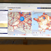
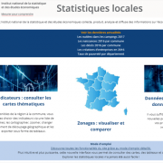
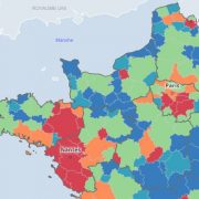
 Among all these projects, some of them are particularly close to our hearts. The INSEE Local Statistics site is one of them. The CGET's Observatoire des Territoires will also soon launch its new Géoclip Air version. The opening of a third national health project is imminent. Health is a field in which Géoclip has been working for a long time. Some examples: the Carsats network, the ARS network, the ATIH, several ORS...
We are also proud of other examples: the Loire-Atlantique Departmental Council, the Hauts-de-France Regional Council, the network of New Aquitaine chambers of commerce, two regional administrations for the environment, development and housing.... Thanks to Géoclip Air, all of them use local statistical data at the level of the territories in which they operate.
Beyond the French borders
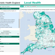
 Another source of satisfaction is the good feedback received by Géoclip Air outside our borders. The Swiss cantons, "historical" customers, quickly welcomed the new version. Géoclip Air also sets foot in Belgium, Spain, England, Canada and even the Pacific Islands. Development abroad will be a major concern in the future.
The new interface displayed by Géoclip Air is only the tip of the iceberg of our work. There are also, on the kitchen side, the tools to manage the administration of an observatory. An important new feature recently introduced is the replication tool. The latter allows you to prepare updates safely, in a pre-production environment, in order to validate them before putting them into production.
Geographic data collections
Our ready-to-use data offer, in the form of thematic collections, is based on a warehouse, fed by available sources of public statistical data. We are continuing to supply this warehouse with quality, reliability and traceability. We also plan to extend its scope to the field of geographic data. This will make it possible to efficiently provide all the necessary map files to build an observatory on any territory in France.
In many projects, several partners share common resources. To make this easier, the TJS (Table Joining Format) web service, already used with Géoclip O3, is still in use. The possibilities offered will even be extended. Other planned developments include geographical selection from an isochronous line, introduction of new types of more advanced graphs in summary sheets and reports, new possibilities to enhance flow data, etc. Another planned development path is the possibility of integrating elements from a Géoclip Air application, for example a map or graph, into another web page.
Emc3 is recruiting
 Géoclip is also, and above all, about people, all of them committed to creating effective but simple tools (and vice versa;). And all of them are concerned with providing the best possible support to project holders, in order to help them make the most of the tool they use. After the intense period of development of Géoclip Air, Emc3 is at a turning point in its history. To ensure its smooth development, a recruitment phase is about to start (notice to potential candidates;))
January is finally the time to make wishes. Our main wish is to continue the project that has been driving us for nearly 20 years: to design, build, distribute and share tools that allow you to explore and analyze statistical data. A better understanding of the world is an essential basis for changing it. With Géoclip, we are committed to this ambition: to better understand the world.


