GEOCLIP USE CASE: THE FRENCH “REGIONAL HEALTH AGENCIES” (ARS’) C@RTOSANTÉ OBSERVATORY
⟫ Download the Géoclip case study - The French “regional health agencies” (PDF)
The French “regional health agencies” (ARS) are responsible for the regional management of the health system in France. They define and implement health policy in the French regions as closely as possible to the needs of the population. The French regional health agencies are carrying out various information dissemination projects, including “C@rtoSanté”, through their geographic portal “AtlaSanté”; these projects aim to support health professionals, territorial decision-makers, researchers, etc. in their decisions in the field of public health.
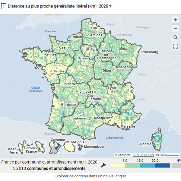
The geostatistical observatory “C@rtoSanté”, based on Géoclip since 2004, is one of the historical ARS projects dedicated to medical demography, demand and access to care for private primary care health professionals - general practitioners, nurses, massage therapists, physiotherapists, dental surgeons, speech therapists and midwives.
C@rtoSanté is the French ARS’ geostatistical observatory that promotes the shared knowledge of territories in terms of supply, demand and access to primary care. Data within C@rtoSanté is rigorously structured according to nine geographic scales, from the most aggregated level (French regions) to the finest level allowed by the data (French communes).
Consult and download the dedicated case study (PDF) now to discover the work of the French regional health agencies (ARS) and, more specifically, of the C@rtoSanté national project team.