Exploring the health conditions in England
The Public Health Service in England has been publishing very detailed data at different territorial levels for many years. In 2012, we announced the publication of Local Health, by Public Health England, based on Géoclip O3. In 2020, an even richer version will go online, now based on Géoclip Air. The objectives are similar to those of Géodes, by Santé Publique France: to make health data easily accessible.
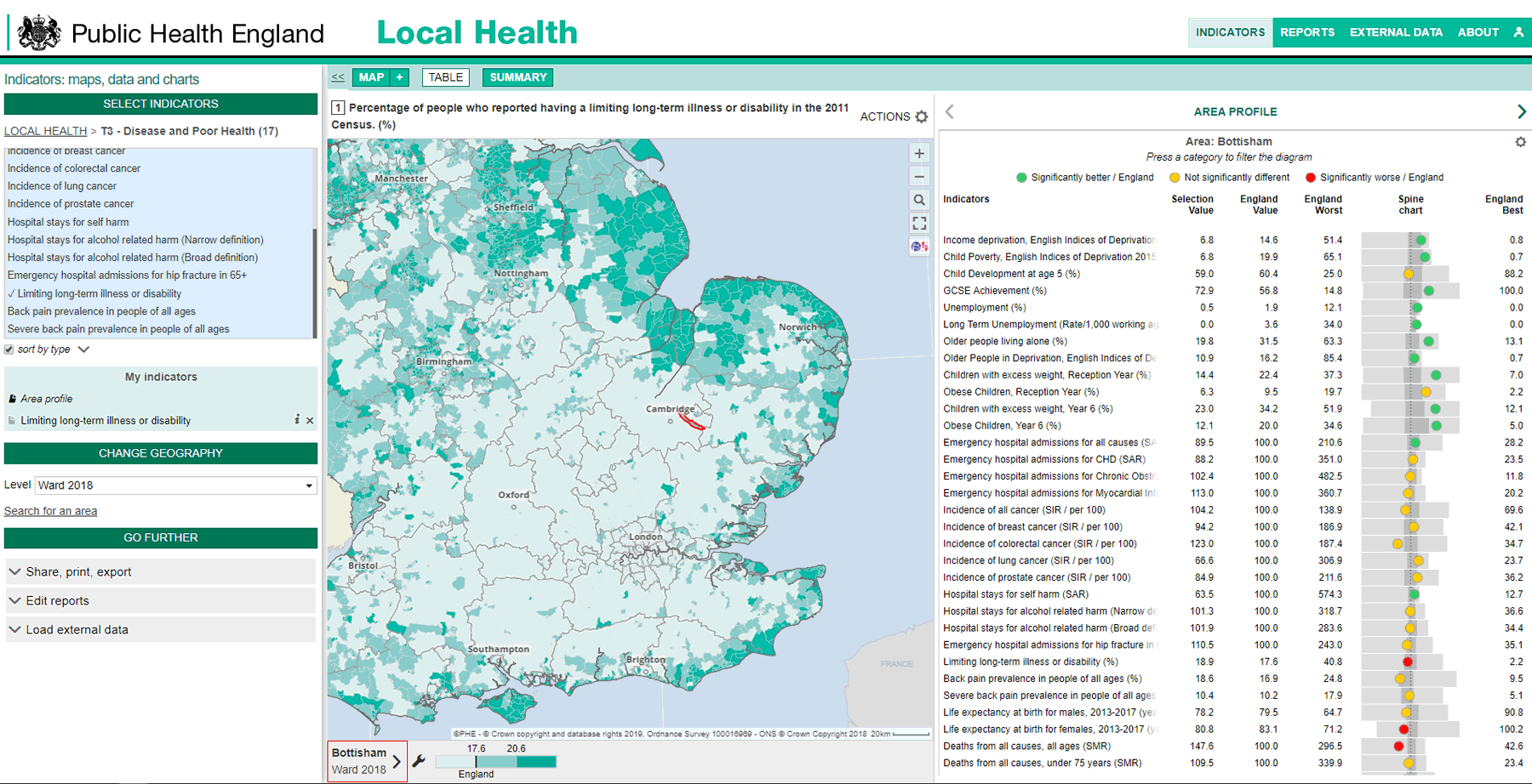
A specific feature of Local Health is to provide access to area profiles. As soon as a geographical area is selected, the SUMMARY panel offers an additional option: in addition to the indicator by indicator reports, the area profile provides a "spine chart" which is a standardized comparative diagram. For a list of indicators, this table provides an array of health indicators for the selected geographical area, plus the England reference value, the minimum and the maximum for all similar areas. In addition, the graphical display shows the distribution range and interquartile range. Coloured markers make it easy to highlight significant differences and interpret them.
https://www.localhealth.org.uk/
Local Health relies on a very detailed geography. MSOAs are geographic units based on statistical groupings of census blocks, much like the French Iris. The CCGs are "Clinical Commissioning Groups", therefore health territories. Wards are electoral districts. The LTLA and UTLA, Lower and Upper Tier Local Authority, are administrative divisions.
This new version of Local Health also offers a rich collection of reports on many themes. A first part is mainly devoted to population, housing, employment... The second part focuses more specifically on health issues: life expectancy, causes of death, risk behaviors, emergencies, hospitalizations... In these reports, diagrams juxtapose the values of the geographical area studied with those of the comparison areas. A colour code directly shows the significant differences.
In order to make it easier for users to get started, a specific help page is provided, entitled How do I? It describes how to perform the main actions: how to change the geographical level, how to add data to the map, how to export or print, how to obtain an area profile, etc.


To explore the health situation in England, a visit to Local Health, published by Public Health England, is a necessary step.


