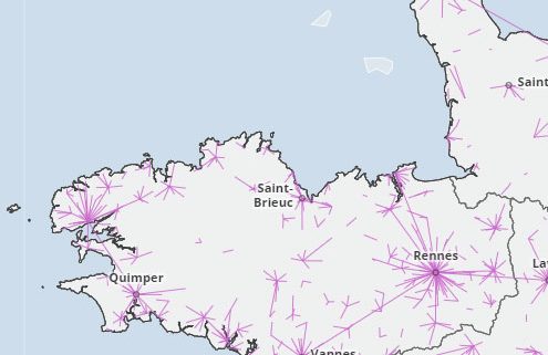
 Hedgehogs map: representation of a simple two-location indicator
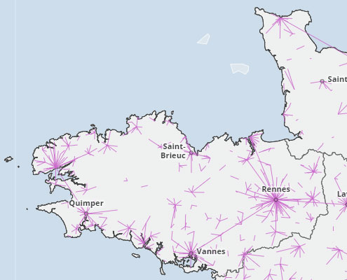
The hedgehogs map makes it possible to highlight the phenomena of polarization between geographical units. It represents a bilocalized indicator: each geographical unit has its own pole of attraction. The attraction is generally from small units to larger ones. A classic example is the home-to-work travel map.
The illustration represents the main trips from home to the place of study, to show where most students from a municipality go for their education.

