 Atlas interactivo de España - Instituto Geográfico Nacional (IGN)

The Spanish Geographic Institute (IGN), under the Ministry of Development (ministerio de Fomento), is in charge of the project of this atlas interactivo de España. This new atlas adds a statistical branch to the geographical information system managed by the institute. What the project initiators were looking for with Géoclip was a truly interactive solution, allowing them to go beyond simple thematic maps, however beautiful and well designed they may be.
This interactive atlas is linked to a much older Spanish project. More than 10 years ago, the Ministry of Housing (now the ministry of Transport, Mobility and Urban Planning - MITMA) had already produced a Digital Atlas of the Áreas Urbanas, first with version 2 of Géoclip, then with Géoclip O3 and finally with Géoclip Air.
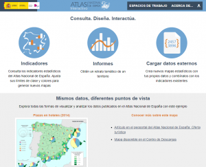
This new atlas interactivo de España offers a wide range of indicators for 3 geographical levels: municipalities, provinces and autonomous communities. The cartographic backgrounds are provided according to 2 areas: a "vista real" and a "vista compacta", depending on whether the Canary Islands are in their geographical location or moved in a specific frame.