Un atlas socio-économique interactif pour le Loir-et-Cher
Plutôt que de présenter classiquement un projet d'atlas interactif qui a récemment vu le jour dans le département du Loir-et-Cher, laissons la parole à Nadège De Clercq, chargée d’études à l’Observatoire de l’Economie et des Territoires et administratrice de cet atlas :
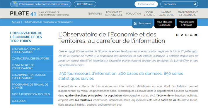
« L’Observatoire de l'Économie et des Territoires est une association régie par la loi du 1er juillet 1901. Né de la volonté de mettre à la disposition des décideurs un outil efficace d'analyse, il s’efforce depuis lors de poser un regard attentif et impartial sur l'actualité économique et sociale des territoires du Loir-et-Cher et des départements voisins.
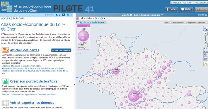
En pleine refonte du site Internet www.pilote41.fr de l’Observatoire, nous étions à la recherche d’un nouveau logiciel de cartographie. Notre objectif était de faire évoluer nos atlas socio-économiques dynamiques vers une consultation possible sur smartphones ou tablettes et de trouver un nouvel outil pour mettre à disposition nos données statistiques en remplacement de notre intranet vieillissant.
Après comparaison des quelques outils du marché existants sur ce segment, notre choix s’est porté vers la solution Geoclip de la société EMC3.
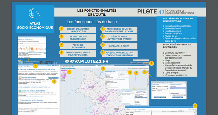
Nous avons été séduits par plusieurs fonctionnalités du produit : l’export des données, l’accès rapide à des rapports en PDF ou Excel sur un territoire, la possibilité de multiplier les vues géographiques et de créer son territoire à façon… la liste des possibilités est longue et nous en découvrons encore tous les jours. »
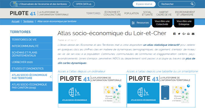

Pilote41 , la plateforme de l'information territoriale, est le site internet géré par l'Observatoire de l'économie et des territoires. Il propose un large éventail de ressources, mises à dispositions des décideurs pour les aider à accéder aux informations disponibles sur le département et son environnement. Parmi ces outils variés, l'atlas interactif construit avec Géoclip O3 trouve toute sa place.

